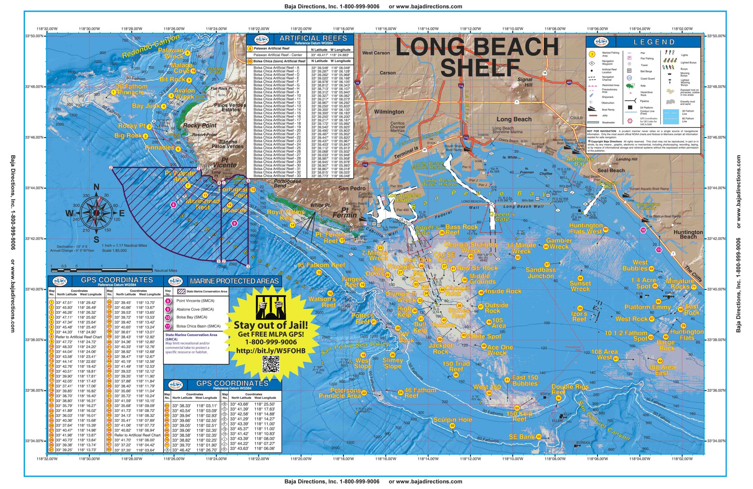
Updated with MLPAs! Our Long Beach Shelf chart covers the Palos Verdes Peninsula to The Cliffs area of Huntington Beach. Included are the Rocky Point, Marineland and Royal Palms areas of Palos Verdes, as well as the entire Horseshoe Kelp and nearby 150 Area of the Long Beach Shelf. Izor's Reef, the 108 Area and the ¼-Acre Spot and Bubbles areas of the Huntington Flats are also covered in detail.
Long Beach Shelf
$18.97
Description
Updated with MLPAs! Our Long Beach Shelf chart covers the Palos Verdes Peninsula to The Cliffs area of Huntington Beach. Included are the Rocky Point, Marineland and Royal Palms areas of Palos Verdes, as well as the entire Horseshoe Kelp and nearby 150 Area of the Long Beach Shelf. Izor’s Reef, the 108 Area and the ¼-Acre Spot and Bubbles areas of the Huntington Flats are also covered in detail.
You must be logged in to post a review.


Reviews
There are no reviews yet.