-
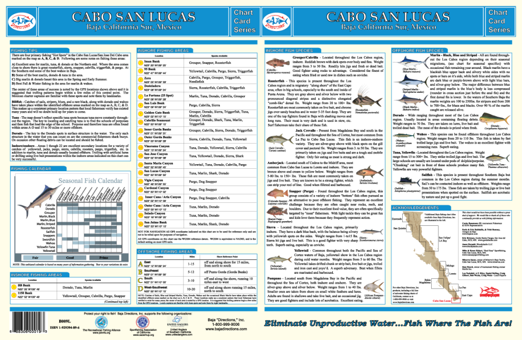
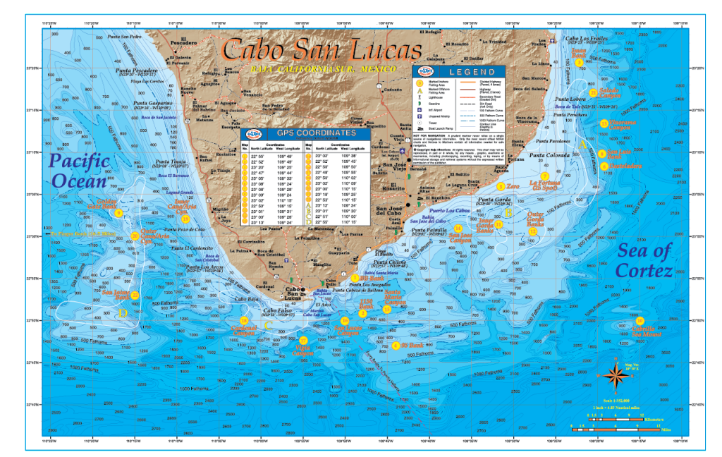 Known by many as the "Sportfishing Capital of the World," Cabo San Lucas at the tip of Baja California surely is an angling paradise. Warm offshore currents from the Sea of Cortez converge here with the cooler waters of the deep blue Pacific Ocean and cause massive temperature breaks that attract a veritable smorgasbord of baitfish for pelagic species such as yellowfin tuna, dorado and wahoo, as well as striped, blue and black marlin. Our Cabo San Lucas fishing chart has been a best seller for years, with underwater contour (bathymetry) data from our Mexican government sources and we absolutely had to make this available. The underwater contours we acquired are absolutely stunning and much more detailed than we ever could imagine. The bottom depth variations are amazing to see as the contours of the ocean floor are shown in stark detail on the chart, in fact this map may easily be the most detailed view of the ocean floor ever produced for the waters off the tip of Baja California! Also, the 100, 500 and 1000 fathom curves are highlighted so you can easily find blue "offshore" water while chasing those pelagic species. Our Cabo San Lucas map reveals such legendary fishing areas as the Gorda Banks, Golden Gate Bank, Vinorama Canyon, the 1150 Bank, Iman Bank, Cabrillo Bank and much more. The chart extent covers from Bahia Los Frailes on the Cortez side and wraps around the Baja Peninsula to the Pacific terminating at Punta Pescadero, just south of the beachside community of Todos Santos. The back side of the chart contains a great deal of information such as explanations on how to fish each highlighted area, GPS coordinates, a seasonal fishing calendar, fish identification chart, and much more.
 -

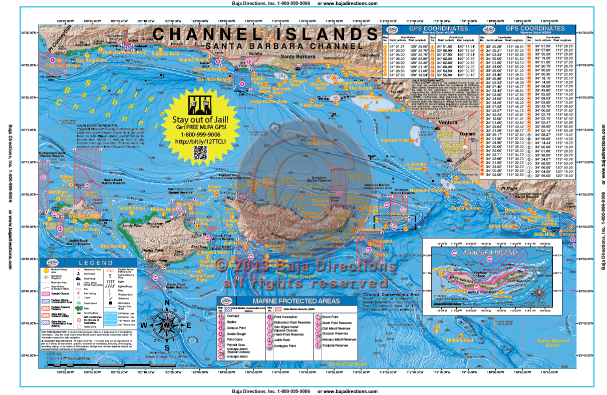 Updated with MLPAs! This chart focuses on the inshore and offshore fishing areas of the Santa Barbara Channel, accessible from Oxnard, Ventura and Santa Barbara harbors. Included are San Miguel, Santa Rosa, Santa Cruz and Anacapa Islands, as well as legendary hotspots like 12-Mile Reef, Horseshoe Reef, Arco Island, Footprint Reef, Hidden Reef and the Santa Rosa Flats. This chart contains valuable information for the private boater such as clearly marked MPA areas, fishing hotspots with GPS coordinates, anchorages, navigation waypoints, headings to and from major Island features and mainland Harbors, as well as expert tips, tactics and techniques by species.
 -
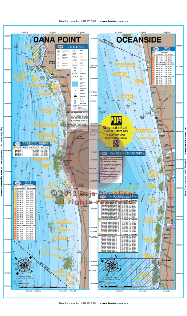 Updated with MLPAs! Our Dana Point to Oceanside chart that covers the fabled Salt Creek area in southern Laguna, down the coast to Cardiff-by-the-Sea in northern San Diego County. Locals will recognize spots like the Barber Poles, Box Canyon, Patterson Kelp, Anderson Pipe and Swami's reef, while the visiting angler will be happy to see such renowned spots as the The Domes, the Barn Kelp and Clambeds.
 -

 With official data from the government of Mexico, our chart of the East Cape region of Baja California between Cabo San Lucas and La Paz is one of our favorites. The area covered by our East Cape title overlaps both our La Paz and Cabo San Lucas fishing map titles; from the southern tip of Isla Cerralvo to just north of Punta Gorda, including the waters off Punta Pescadero, Los Barrilles, Punta Colorada, Cabo Pulmo and Los Frailes. Fishing areas shown in the East Cape region include Pescadero (a.k.a. "Tuna") Canyon, Vinorama Beach and Los Frailes Canyon. The underwater contours we acquired from the Mexican government are nothing short of spectacular, in fact this chart may easily be the most detailed view of the ocean floor ever produced for the waters off the East Cape region. Also, the 100, 500 and 1000 fathom curves are highlighted so you can easily find the "blue water" while chasing those pelagic species offshore. This chart also shows the locations of all the hotels on the East Cape, making this chart a must-have for the shore angler so he can stay on the bite. The back side of the chart contains a great deal of information such as explanations on how to fish each highlighted area, GPS coordinates, a seasonal fishing calendar, fish identification chart, and much more.
 -
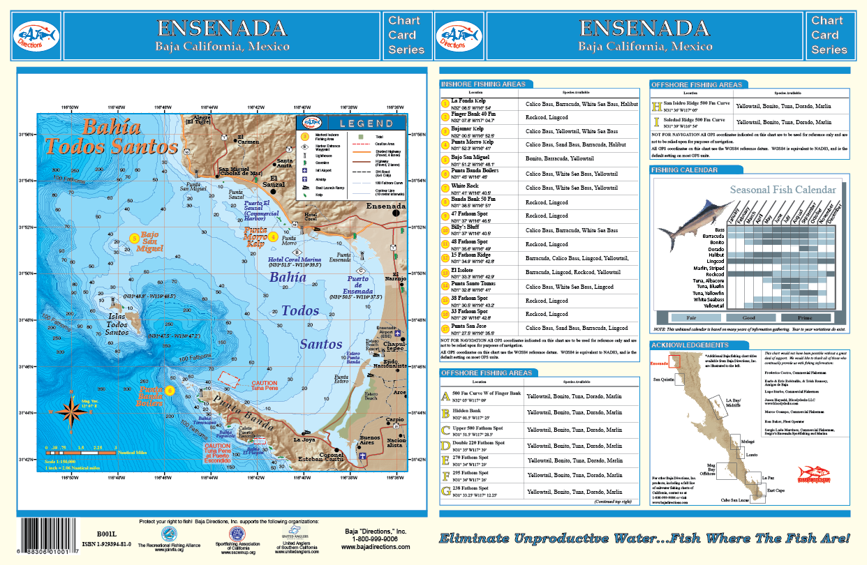
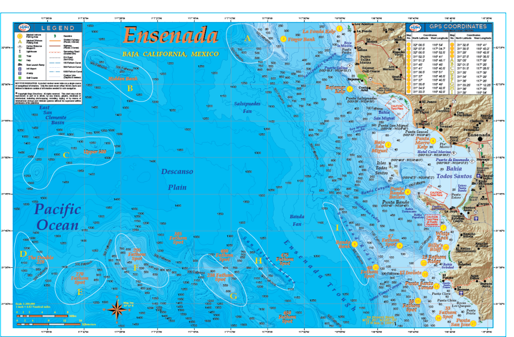 Our Ensenada chart covers the fishing areas from the kelp beds of La Fonda located just north of Puerto La Salina, to Punta San Jose to the south, a good hour's run down the coast from Ensenada. This chart features GPS numbers and locations of both offshore and inshore fishing areas such as the Hidden Bank, Upper 500 Fathom Spot, Banda Bank, Bajo San Miguel and the Double 220 Fathom Spot, as well as lesser known areas such as El Isolote and White Rock - small rocky islets jutting from the ocean's surface off Punta Santo Tomas and Punta Banda respectively. The underwater contours (bathymetry) of this chart were rendered from a private survey for natural gas and oil exploration and remain the absolute most detailed view of the ocean floor off Ensenada in existence! Also featured is a separate large-scale chart of Bahia Todos Santos that details out the harbor areas of Ensenada, including the popular Hotel Coral & Marina. This full color, high-resolution chart also features a seasonal fishing calendar which lists the best months for fishing by species and is currently available exclusively in our popular 11"x17" laminated format.
 -
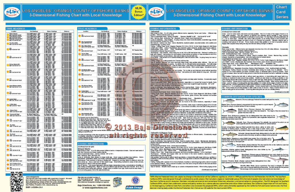
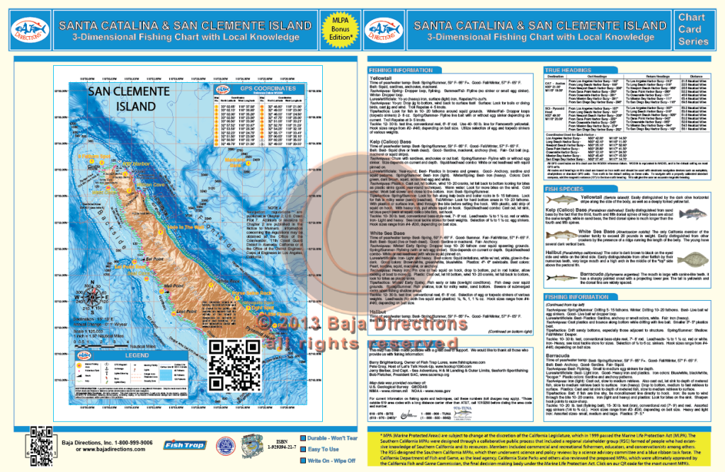
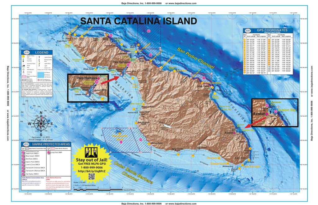
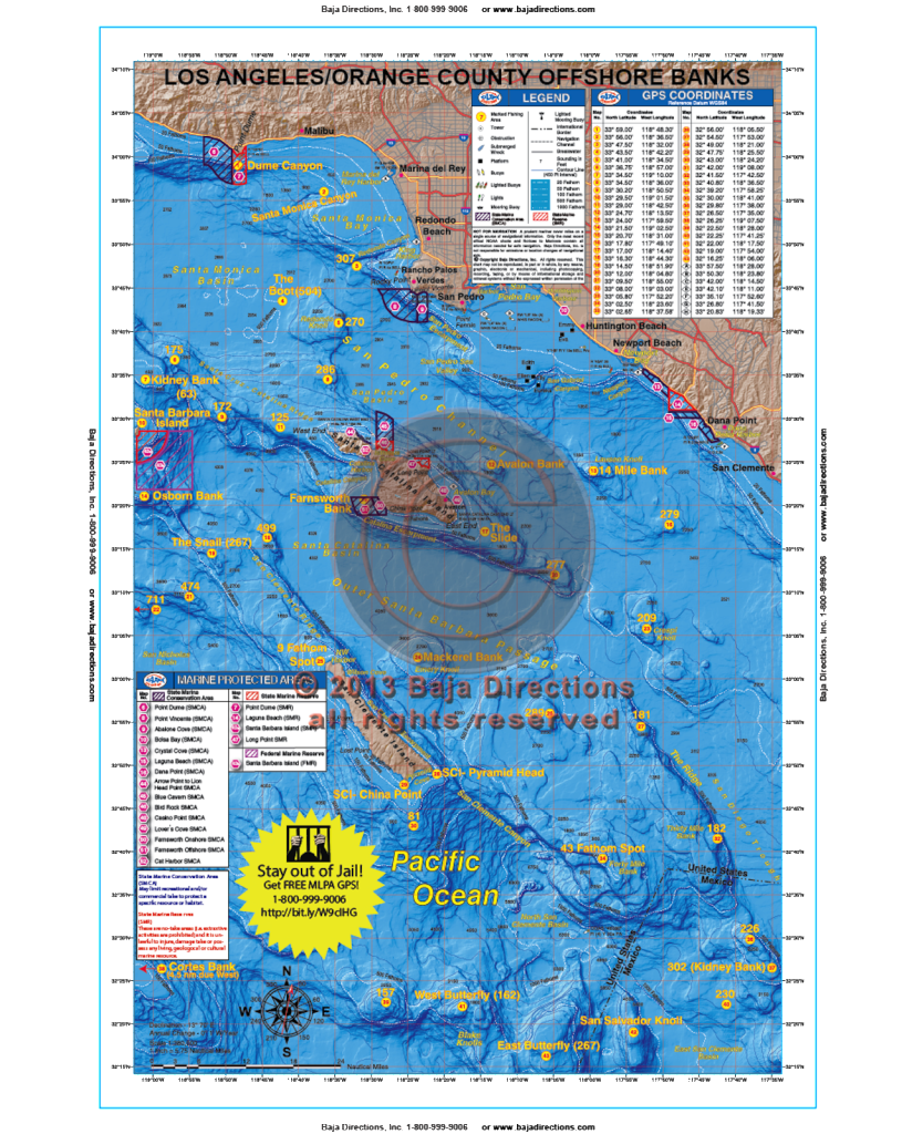 Updated with MLPAs! This chart covers the offshore fishing areas from Marina del Rey to Dana Point and includes the Santa Barbara, Santa Catalina and San Clemente Islands. This popular chart now includes water as far south as The Butterfly and as far west as the Cortes and Tanner Banks, as well as added hotspots like the Boot Bank, The Snail and 499 Spot. The chart contains valuable information for the private boater such as clearly marked fishing hotspots with GPS coordinates and compass headings to and from all major harbors, expert tips and techniques by species and a fish identification chart that includes information on how to properly identify each featured species.
 -
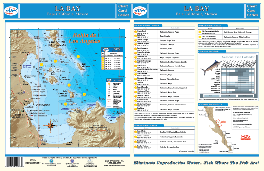
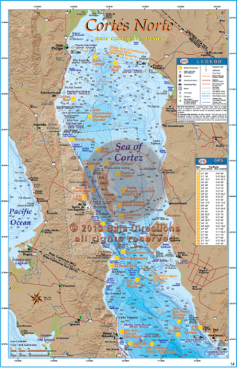
 This chart covers from Punta Final to the north, south to Bahia San Francisquito and includes the northern islands of the Sea of Cortez's Midriff Island region such as Isla Angel de la Guarda, Isla Partida, Isla Rasa, Isla Salsipuedes, Isla Animas, Isla Esteban and many more. The locations of 17 popular fishing areas such as Isla Estanque (Snake Island), Isla Smith, Los Candeleros and Bajo Guadalupe are shown precisely on the chart along with their corresponding GPS coordinates. Also featured are a seasonal fishing calendar, and a large-scale chart of Bahia de los Angeles which shows many of the popular fishing spots and underwater contours of the Bahia itself, along with the facilities at LA Bay for boat launching, camping, lodging and more! This full color, high-resolution chart is currently available exclusively in our popular 11"x17" laminated format.
 -
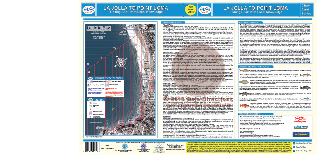
 Updated with MLPAs! Our La Jolla to Point Loma chart is sure to be a hit with local anglers and visiting anglers alike. This chart covers the La Jolla Kelp and Point Loma Kelp areas in detail never seen before. Spots like The 32, The Airplane, Variety Kelp, Jetty Kelp and The Pine Tree are sure to intrigue veteran fisherman, while newcomers will benefit from the locations of such perennial hotspots like Northwest Corner, the Green Tank and the DO.