Updated with MLPAs! Our Newport to Dana chart covers the Orange County coast from Huntington Beach down to Doheny Beach on the south side of Dana Point. This chart covers spots like Izor's Reef, the 108 Area and the Santa Ana River Pipe areas on the east side of the Long Beach Shelf, all the way south through the myriad spots along the cliffs of Laguna. The chart's southern end terminates at the entrance to Dana Point Harbor, but not before showing the locations of such fine fishing spots as Pelican Point Reef, the Blue Roof Area, the Laguna Pinnacles, 1000 Steps Kelp, the 100 Fathom Curve off the Hospital in South Laguna and the Monarch Boilers.
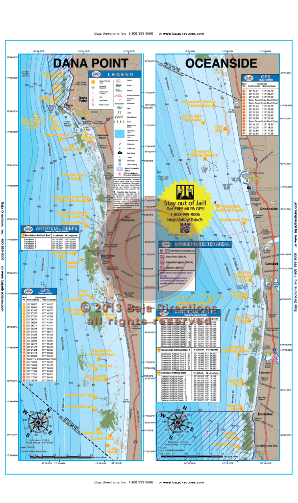 Updated with MLPAs! Our Dana Point to Oceanside chart that covers the fabled Salt Creek area in southern Laguna, down the coast to Cardiff-by-the-Sea in northern San Diego County. Locals will recognize spots like the Barber Poles, Box Canyon, Patterson Kelp, Anderson Pipe and Swami's reef, while the visiting angler will be happy to see such renowned spots as the The Domes, the Barn Kelp and Clambeds.
 Updated with MLPAs! Our Newport to Dana chart covers the Orange County coast from Huntington Beach down to Doheny Beach on the south side of Dana Point. This chart covers spots like Izor's Reef, the 108 Area and the Santa Ana River Pipe areas on the east side of the Long Beach Shelf, all the way south through the myriad spots along the cliffs of Laguna. The chart's southern end terminates at the entrance to Dana Point Harbor, but not before showing the locations of such fine fishing spots as Pelican Point Reef, the Blue Roof Area, the Laguna Pinnacles, 1000 Steps Kelp, the 100 Fathom Curve off the Hospital in South Laguna and the Monarch Boilers.