-
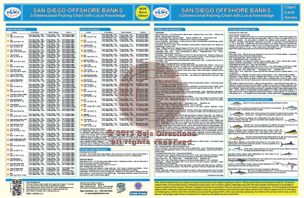
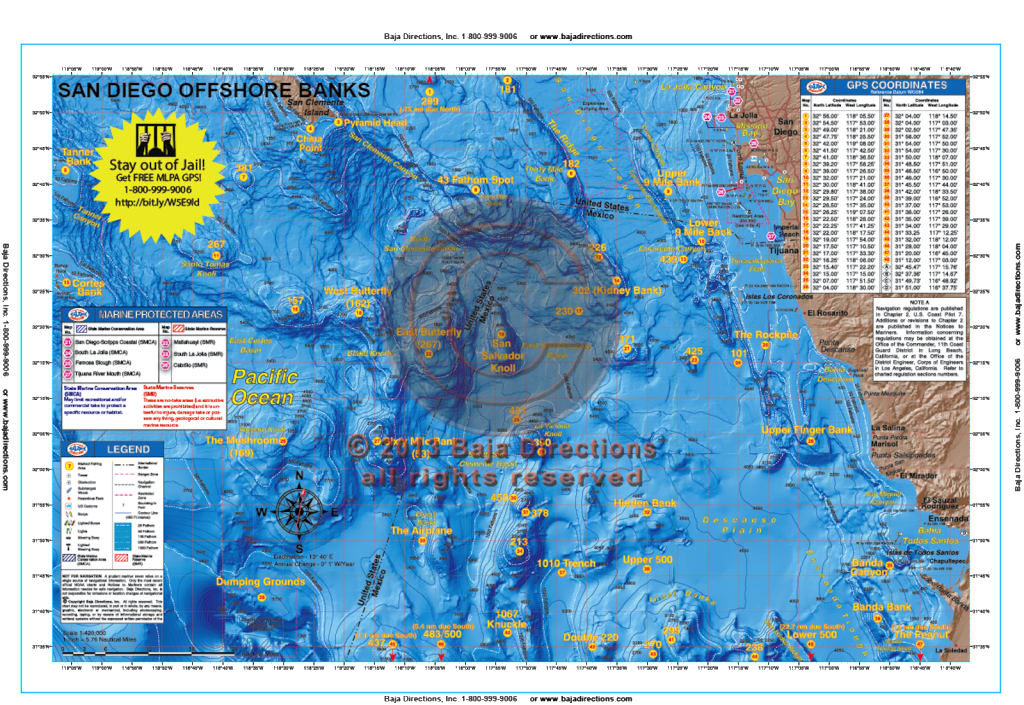 Updated with MLPAs! This chart covers the offshore fishing areas from the southern half of San Clemente Island, south to the fabled "Inner Banks" area off Ensenada. The chart now includes water as far west as the Cortes and Tanner Banks, as well as areas like the Upper 500, 483/500 and the Knuckle which can be especially hot depending on the year. Valuable information for the private boater such as clearly marked fishing hotspots with GPS coordinates and compass headings to and from all major harbors, expert tips and techniques by species and a fish identification chart that includes information on how to properly identify each featured species are included.
 -
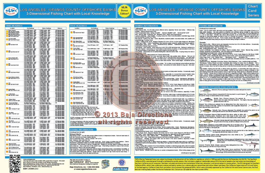
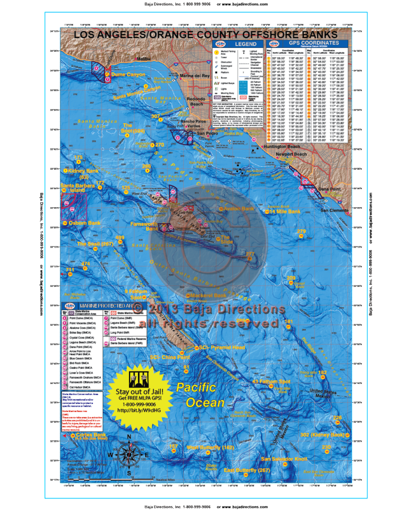 Updated with MLPAs! This chart covers the offshore fishing areas from Marina del Rey to Dana Point and includes the Santa Barbara, Santa Catalina and San Clemente Islands. This popular chart now includes water as far south as The Butterfly and as far west as the Cortes and Tanner Banks, as well as added hotspots like the Boot Bank, The Snail and 499 Spot. The chart contains valuable information for the private boater such as clearly marked fishing hotspots with GPS coordinates and compass headings to and from all major harbors, expert tips and techniques by species and a fish identification chart that includes information on how to properly identify each featured species.