Description
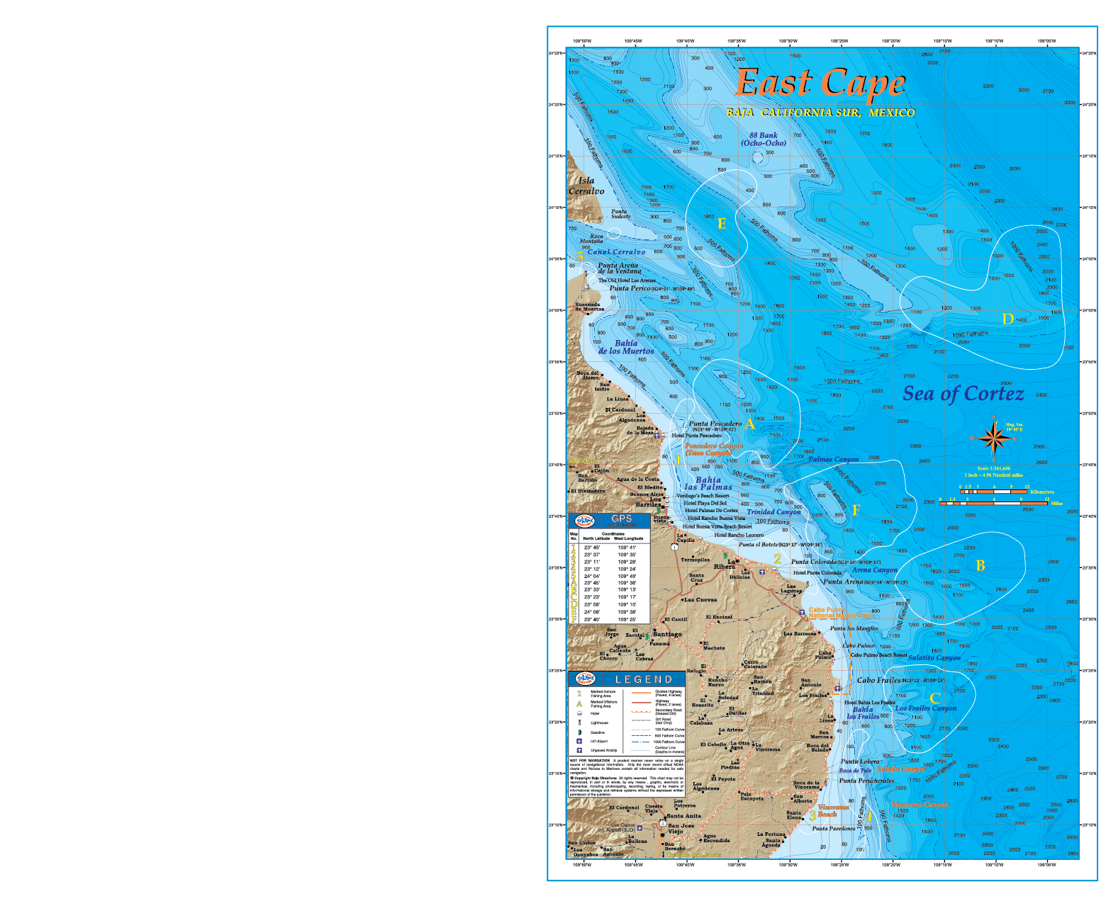
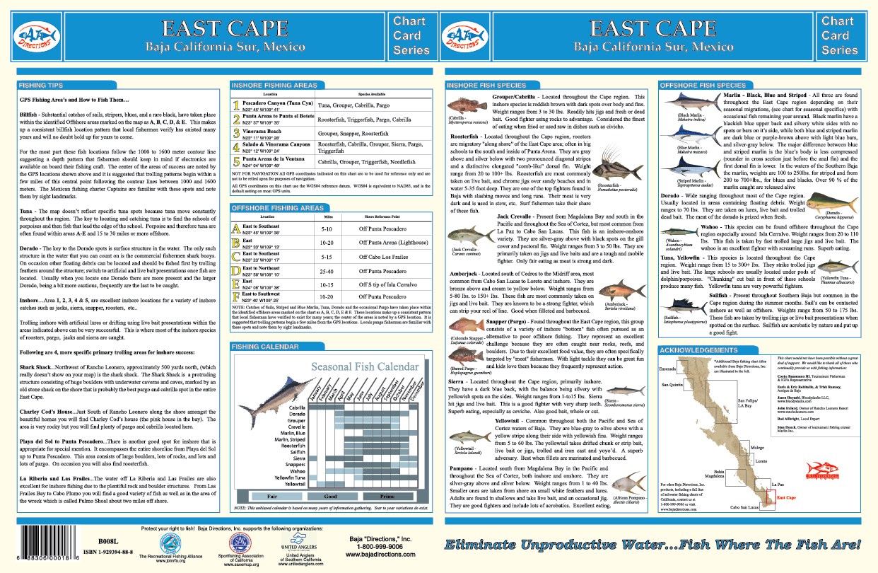
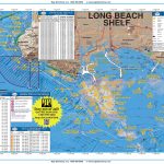
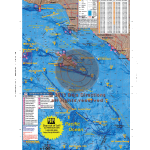
With official data from the government of Mexico, our chart of the East Cape region of Baja California between Cabo San Lucas and La Paz is one of our favorites. The area covered by our East Cape title overlaps both our La Paz and Cabo San Lucas fishing map titles; from the southern tip of Isla Cerralvo to just north of Punta Gorda, including the waters off Punta Pescadero, Los Barrilles, Punta Colorada, Cabo Pulmo and Los Frailes. Fishing areas shown in the East Cape region include Pescadero (a.k.a. “Tuna”) Canyon, Vinorama Beach and Los Frailes Canyon. The underwater contours we acquired from the Mexican government are nothing short of spectacular, in fact this chart may easily be the most detailed view of the ocean floor ever produced for the waters off the East Cape region. Also, the 100, 500 and 1000 fathom curves are highlighted so you can easily find the “blue water” while chasing those pelagic species offshore. This chart also shows the locations of all the hotels on the East Cape, making this chart a must-have for the shore angler so he can stay on the bite. The back side of the chart contains a great deal of information such as explanations on how to fish each highlighted area, GPS coordinates, a seasonal fishing calendar, fish identification chart, and much more.
Reviews
There are no reviews yet.