-
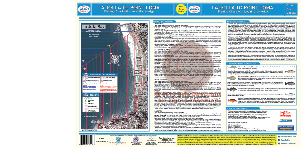
 Updated with MLPAs! Our La Jolla to Point Loma chart is sure to be a hit with local anglers and visiting anglers alike. This chart covers the La Jolla Kelp and Point Loma Kelp areas in detail never seen before. Spots like The 32, The Airplane, Variety Kelp, Jetty Kelp and The Pine Tree are sure to intrigue veteran fisherman, while newcomers will benefit from the locations of such perennial hotspots like Northwest Corner, the Green Tank and the DO.
 -

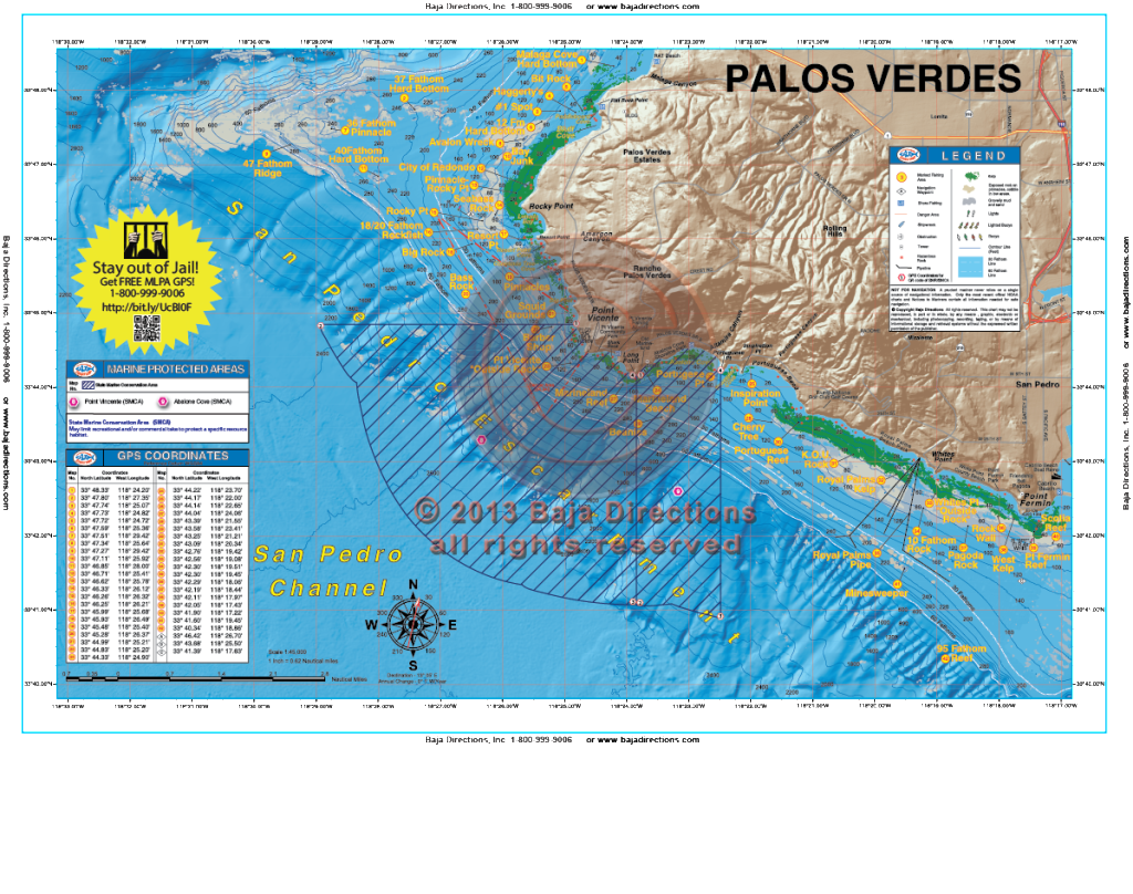 Updated with MLPAs! Our detailed chart of the Palos Verdes Peninsula covers the entire peninsula, from its northern beginnings at Malaga Cove to its abrupt end at Cabrillo Beach, the west end of the Long Beach Breakwater. Included are the Bay Junk and Seabass Rock areas of Rocky Point, as well as such storied areas as the Pinnacles, the Barber Shop, Marineland Reef and Pt. Fermin Reef.
 -

 Updated with MLPAs! Our chart of Newport Harbor made its debut in our atlas and covers the entire lower Newport Bay, from the entrance between the jetties, to the channel leading into the Back Bay. This chart points out the main fish-holding features of the bay and even includes special fishing tips from the master of fishing Newport Bay, Mike Gardner.
 -
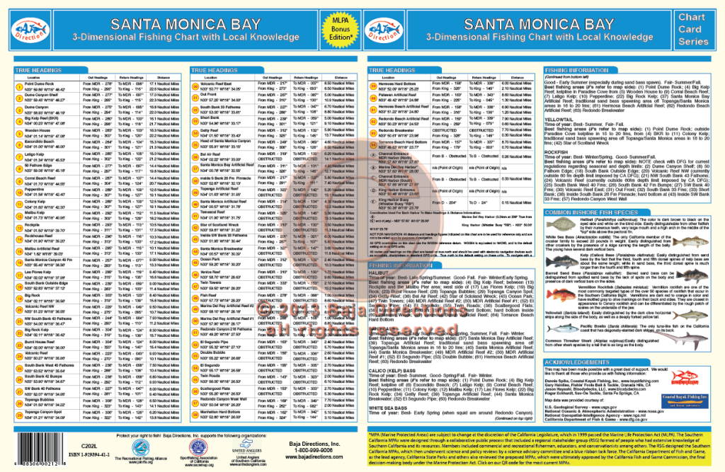
 Updated with MLPAs! Our Santa Monica Bay chart covers the Malibu coast from the west side of Point Dume, all the way around the bay to the head of the Redondo Canyon. Legendary spots like the Big Kelp Reef (BKR), Twin Towers, El Segundo Pipe and Short Banks are covered, as well as lesser-known areas such as the Corral Beach Reef, Big Rock and the hard bottom off Manhattan Beach.
 -
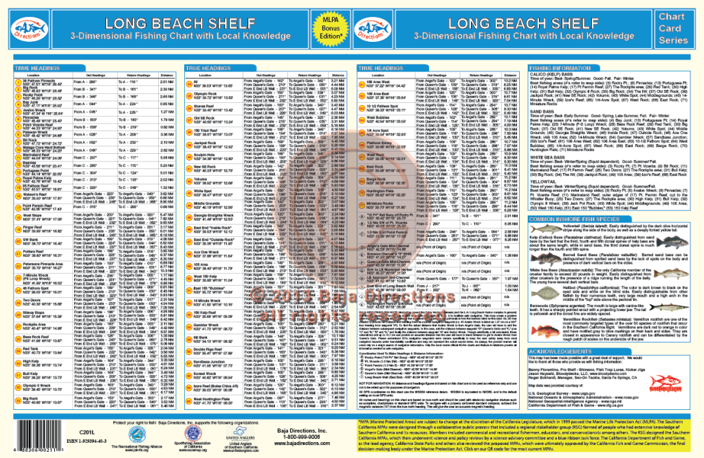
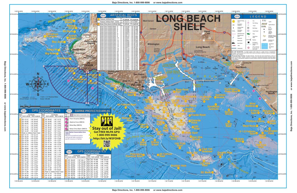 Updated with MLPAs! Our Long Beach Shelf chart covers the Palos Verdes Peninsula to The Cliffs area of Huntington Beach. Included are the Rocky Point, Marineland and Royal Palms areas of Palos Verdes, as well as the entire Horseshoe Kelp and nearby 150 Area of the Long Beach Shelf. Izor's Reef, the 108 Area and the ¼-Acre Spot and Bubbles areas of the Huntington Flats are also covered in detail.
 -

 Updated with MLPAs! This chart covers both San Diego and Mission Bays in great detail and provides valuable information from experts like Barry Brightenburg, owner of Fish Trap Lures, on the best spots to fish, when to fish them, and how to fish them. Fish-holding areas like eelgrass beds, clam beds, submerged cable, underwater jetties and platforms are highlighted on the chart, as well as important boating information like Security Zones around Naval facilities and the locations of fuel docks and marinas in both Harbors. An added feature of this updated chart is a series of navigation waypoints lining the Main Channel that aid in nighttime navigation, both departing and returning to San Diego Bay. In addition, there is important information pertaining to boater safety and fish identification.
 -
 Updated with MLPAs! Our Newport to Dana chart covers the Orange County coast from Huntington Beach down to Doheny Beach on the south side of Dana Point. This chart covers spots like Izor's Reef, the 108 Area and the Santa Ana River Pipe areas on the east side of the Long Beach Shelf, all the way south through the myriad spots along the cliffs of Laguna. The chart's southern end terminates at the entrance to Dana Point Harbor, but not before showing the locations of such fine fishing spots as Pelican Point Reef, the Blue Roof Area, the Laguna Pinnacles, 1000 Steps Kelp, the 100 Fathom Curve off the Hospital in South Laguna and the Monarch Boilers.
 -
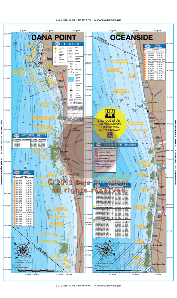 Updated with MLPAs! Our Dana Point to Oceanside chart that covers the fabled Salt Creek area in southern Laguna, down the coast to Cardiff-by-the-Sea in northern San Diego County. Locals will recognize spots like the Barber Poles, Box Canyon, Patterson Kelp, Anderson Pipe and Swami's reef, while the visiting angler will be happy to see such renowned spots as the The Domes, the Barn Kelp and Clambeds.
 -
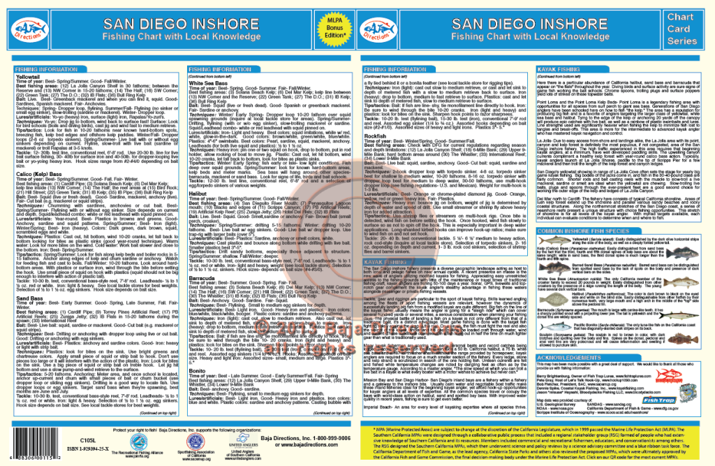
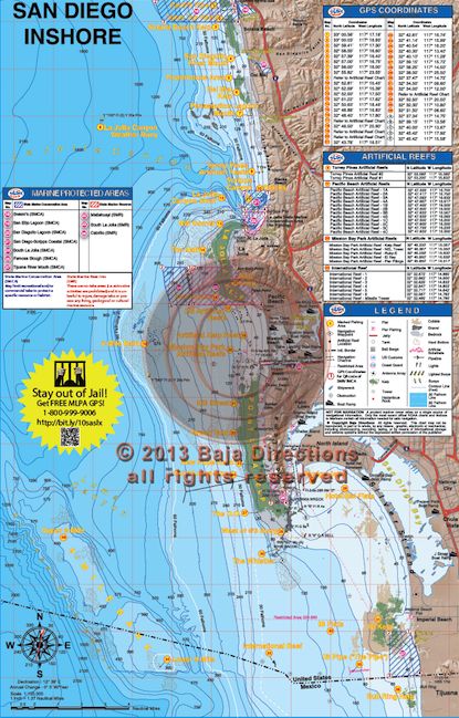 Updated with MLPAs! This chart covers the inshore fishing areas from Cardiff in north San Diego County to "The Bullring", just south of the Mexican border. Inshore anglers focusing on detailed bottom features will appreciate the larger scale of the updated version of this chart. Coverage is from the shoreline out to eleven miles offshore and features such talked-about fishing spots as the Northwest Corner and Variety Kelp areas of the La Jolla Kelp, the Green Tanks and DO areas of Point Loma Kelp and also the Imperial Beach Pipe. The chart contains valuable information for the private boater such as clearly marked fishing hotspots with GPS coordinates, expert tips, tactics and techniques by species, locations of launch ramps, jetties, artificial reefs and buoys, plus our new bottom composition and kelp data acquired from Scripps Institute!