-

 Updated with MLPAs! Our chart of Newport Harbor made its debut in our atlas and covers the entire lower Newport Bay, from the entrance between the jetties, to the channel leading into the Back Bay. This chart points out the main fish-holding features of the bay and even includes special fishing tips from the master of fishing Newport Bay, Mike Gardner.
 -
 B014L-The Lower Banks - 11x17 Laminated
 -

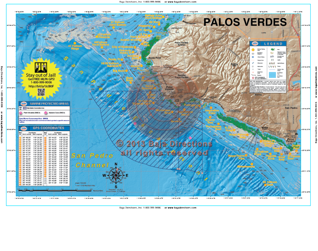 Updated with MLPAs! Our detailed chart of the Palos Verdes Peninsula covers the entire peninsula, from its northern beginnings at Malaga Cove to its abrupt end at Cabrillo Beach, the west end of the Long Beach Breakwater. Included are the Bay Junk and Seabass Rock areas of Rocky Point, as well as such storied areas as the Pinnacles, the Barber Shop, Marineland Reef and Pt. Fermin Reef.
 -
 Updated with MLPAs! Our Newport to Dana chart covers the Orange County coast from Huntington Beach down to Doheny Beach on the south side of Dana Point. This chart covers spots like Izor's Reef, the 108 Area and the Santa Ana River Pipe areas on the east side of the Long Beach Shelf, all the way south through the myriad spots along the cliffs of Laguna. The chart's southern end terminates at the entrance to Dana Point Harbor, but not before showing the locations of such fine fishing spots as Pelican Point Reef, the Blue Roof Area, the Laguna Pinnacles, 1000 Steps Kelp, the 100 Fathom Curve off the Hospital in South Laguna and the Monarch Boilers.
 -
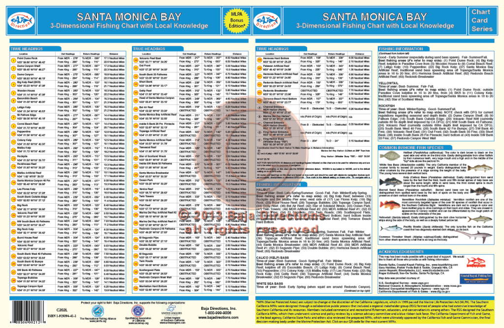
 Updated with MLPAs! Our Santa Monica Bay chart covers the Malibu coast from the west side of Point Dume, all the way around the bay to the head of the Redondo Canyon. Legendary spots like the Big Kelp Reef (BKR), Twin Towers, El Segundo Pipe and Short Banks are covered, as well as lesser-known areas such as the Corral Beach Reef, Big Rock and the hard bottom off Manhattan Beach.