-
 B014L-The Lower Banks - 11x17 Laminated
 -
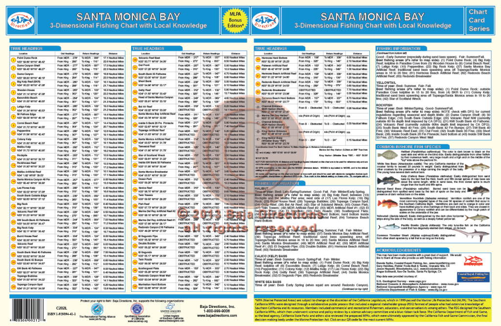
 Updated with MLPAs! Our Santa Monica Bay chart covers the Malibu coast from the west side of Point Dume, all the way around the bay to the head of the Redondo Canyon. Legendary spots like the Big Kelp Reef (BKR), Twin Towers, El Segundo Pipe and Short Banks are covered, as well as lesser-known areas such as the Corral Beach Reef, Big Rock and the hard bottom off Manhattan Beach.
 -
Out of stock
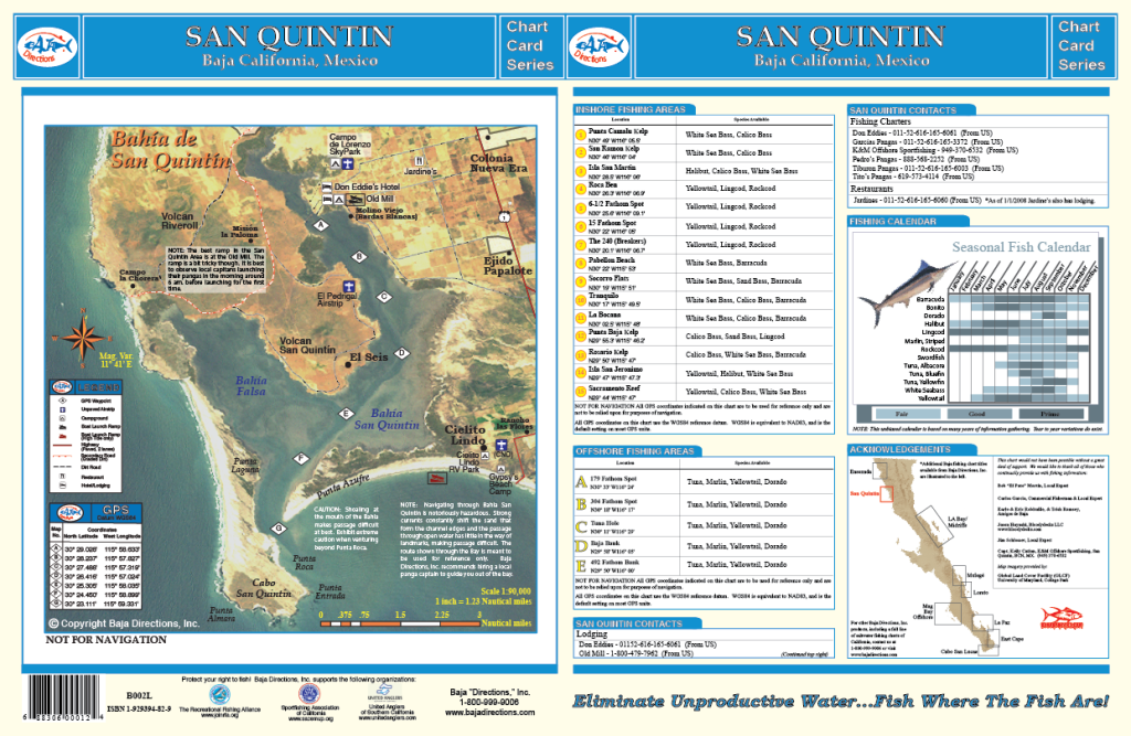
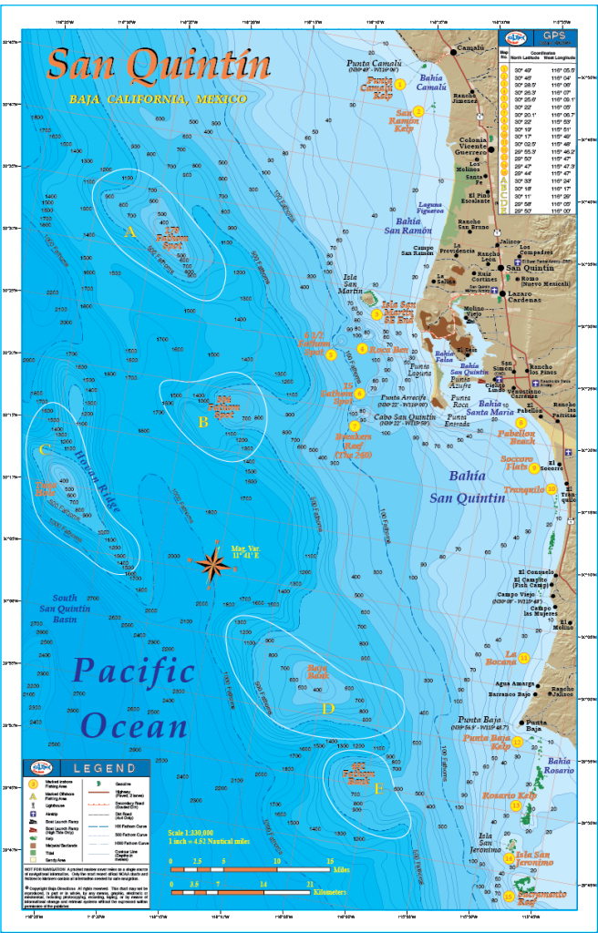 This chart is laminated and measures 11 X 17. We made quite a few changes from our original San Quintin title by shifting the focus of our chart to a larger scale and including the great fishing areas a full day boat ride to the south of San Quintin. This map encompasses the Baja coast from Punta Camalu to the north and Sacramento Reef to the south, including Isla Jeronimo, Punta Baja and Isla San Martin. The GPS numbers of prime bottom fishing areas like Ben's Rock, Breakers Reef (a.k.a. The 240), and the 61/2 Fathom Spot are featured on the chart, as well as the white sea bass areas of increasing fame such as Pabellon Beach, El Tranquilo and Socorro. Also included is a satellite image of Bahia San Quintin taken on an extraordinarily clear water day which distinctly shows the infamous channel in and out of the bay. We have also acquired GPS numbers marking the channel from a gentleman who has 30 years experience navigating through the bay! The positions of these GPS waypoints have been precisely overlayed on top of the satellite photo, giving you a frame of reference as to where in the channel each waypoint is. Baja Directions, Inc. still recommends hiring a local guide to get you safely in and out of the bay at least the first few times, but this incredible resource is a must-have for the experienced and first-timer alike as it will definitely shorten your learning curve. The locations of the most popular facilities in the San Quintin area such as the Old Mill, Don Eddies, Campo de Lorenzo sky park and more are also pointed out on the satellite image, making this chart a one-stop resource for the traveling fisherman.
 -
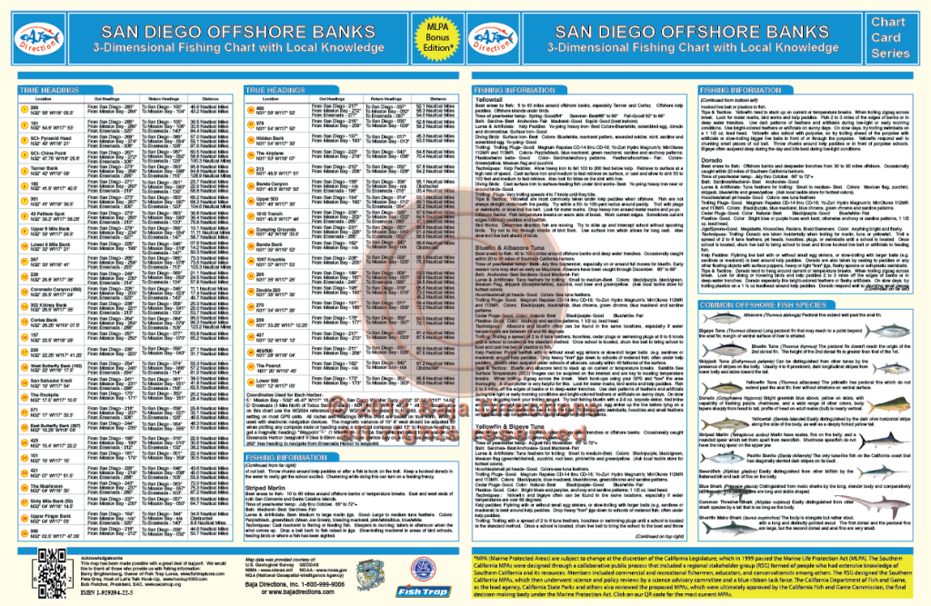
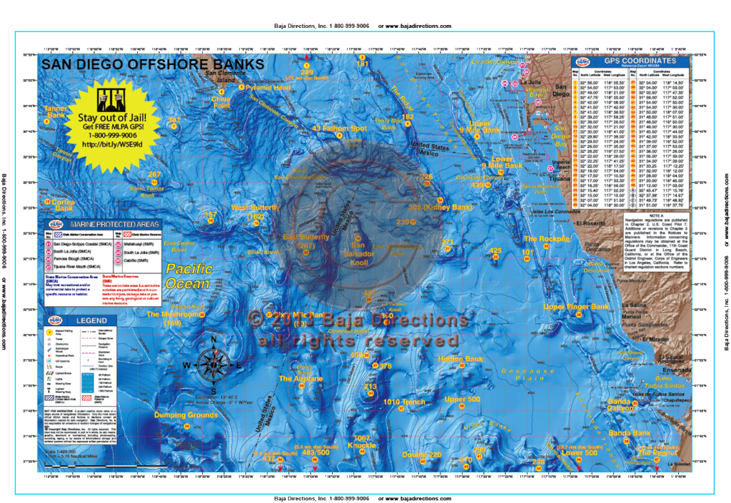 Updated with MLPAs! This chart covers the offshore fishing areas from the southern half of San Clemente Island, south to the fabled "Inner Banks" area off Ensenada. The chart now includes water as far west as the Cortes and Tanner Banks, as well as areas like the Upper 500, 483/500 and the Knuckle which can be especially hot depending on the year. Valuable information for the private boater such as clearly marked fishing hotspots with GPS coordinates and compass headings to and from all major harbors, expert tips and techniques by species and a fish identification chart that includes information on how to properly identify each featured species are included.
 -
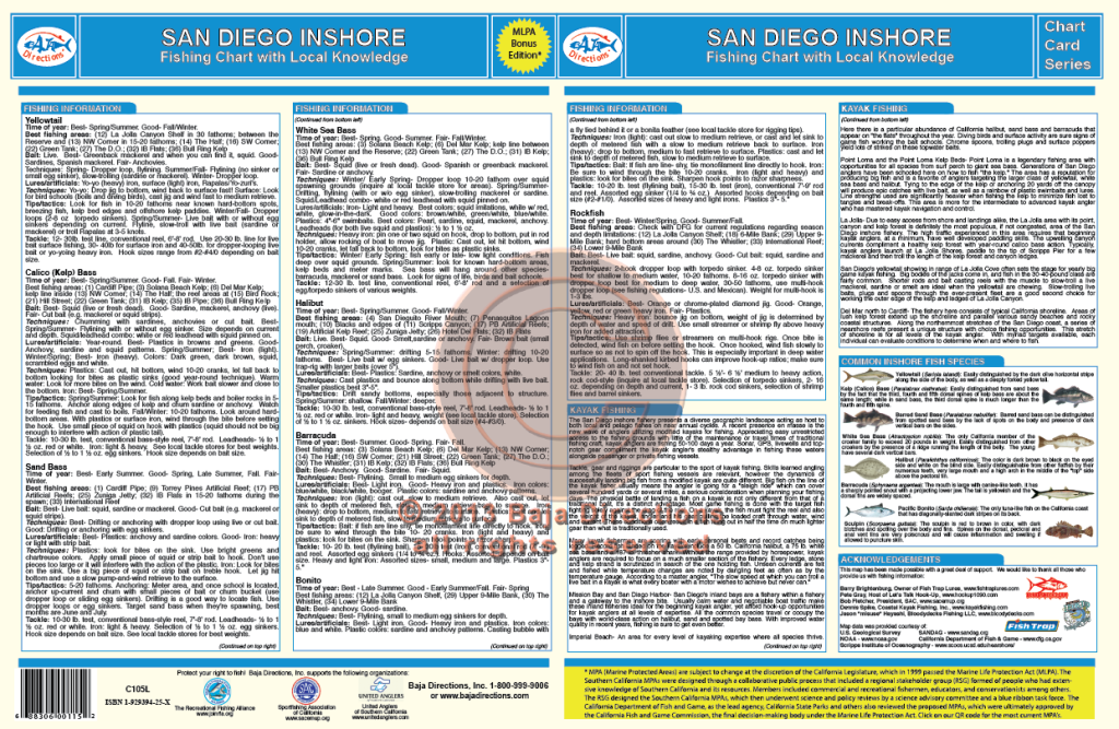
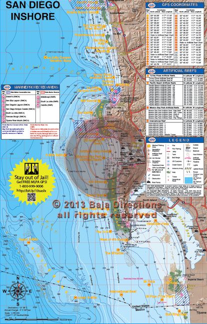 Updated with MLPAs! This chart covers the inshore fishing areas from Cardiff in north San Diego County to "The Bullring", just south of the Mexican border. Inshore anglers focusing on detailed bottom features will appreciate the larger scale of the updated version of this chart. Coverage is from the shoreline out to eleven miles offshore and features such talked-about fishing spots as the Northwest Corner and Variety Kelp areas of the La Jolla Kelp, the Green Tanks and DO areas of Point Loma Kelp and also the Imperial Beach Pipe. The chart contains valuable information for the private boater such as clearly marked fishing hotspots with GPS coordinates, expert tips, tactics and techniques by species, locations of launch ramps, jetties, artificial reefs and buoys, plus our new bottom composition and kelp data acquired from Scripps Institute!
 -

 Updated with MLPAs! This chart covers both San Diego and Mission Bays in great detail and provides valuable information from experts like Barry Brightenburg, owner of Fish Trap Lures, on the best spots to fish, when to fish them, and how to fish them. Fish-holding areas like eelgrass beds, clam beds, submerged cable, underwater jetties and platforms are highlighted on the chart, as well as important boating information like Security Zones around Naval facilities and the locations of fuel docks and marinas in both Harbors. An added feature of this updated chart is a series of navigation waypoints lining the Main Channel that aid in nighttime navigation, both departing and returning to San Diego Bay. In addition, there is important information pertaining to boater safety and fish identification.
 -

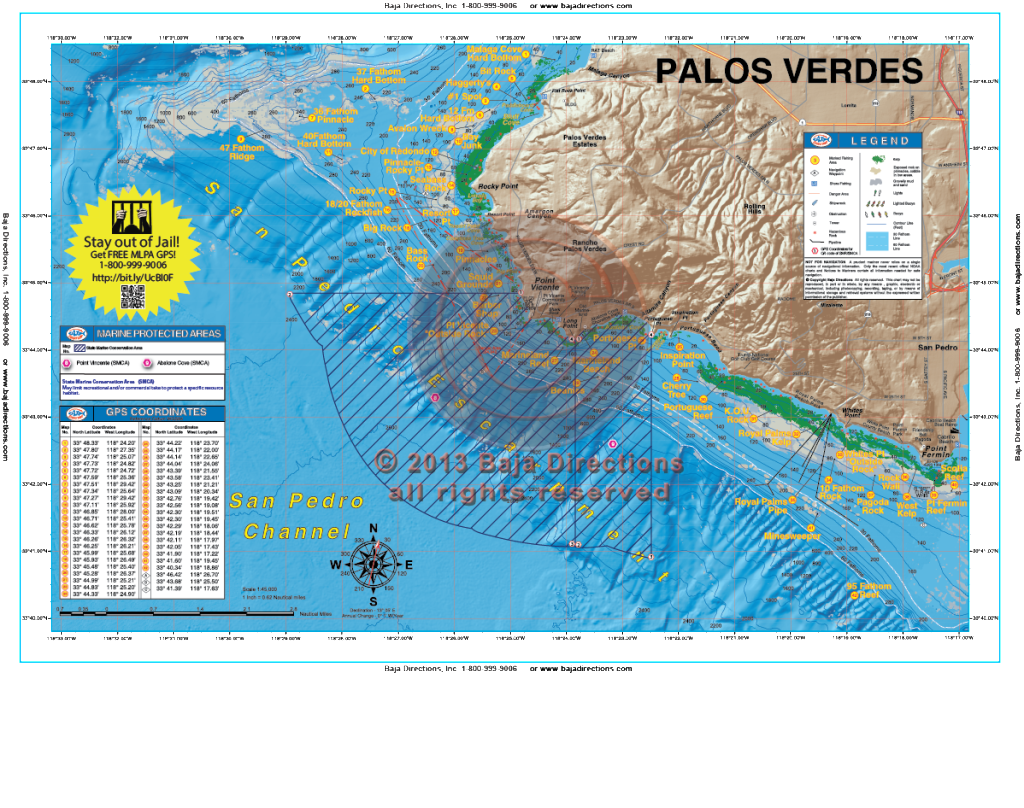 Updated with MLPAs! Our detailed chart of the Palos Verdes Peninsula covers the entire peninsula, from its northern beginnings at Malaga Cove to its abrupt end at Cabrillo Beach, the west end of the Long Beach Breakwater. Included are the Bay Junk and Seabass Rock areas of Rocky Point, as well as such storied areas as the Pinnacles, the Barber Shop, Marineland Reef and Pt. Fermin Reef.